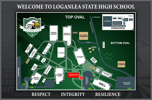
Download school map (PDF2.29MB)
Loganlea SHS is conveniently located to maximise a variety of transport options to and from school. Although general information is provided, for more detailed public transport routes and timetables, please contact Translink.
Trains
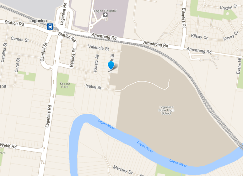
Loganlea SHS is located an easy 5 minute walk from the Loganlea train station. Regular services (at least every 15 minutes) run from both the North and South of this station.
School students can travel to and from school on any TransLink service, regional qconnect or designated school bus services.
You can use the journey planner to find the best service to and from your school.
If you already know your bus route number, you can also search for your school timetable.
Primary and secondary school students are eligible for concession fares. Eligible students may be entitled to additional fare assistance.
Buses
A number of school bus services operate to Loganlea SHS. Logan Coaches current school run information is provided below. Parents should access the Logan Coaches website for the latest information.
To view most current Runs, please visit the Logan Coaches website. www.logancoaches.com.au/
Cars
When parents drop off their children at school they are asked to please access either the cul-de-sac and entrance at Valencia Street, or the area approaching the Neridah Street entrance. Parents with appointments at administration are invited to use parking within the Neridah Street entrance.